KEY FEATURES
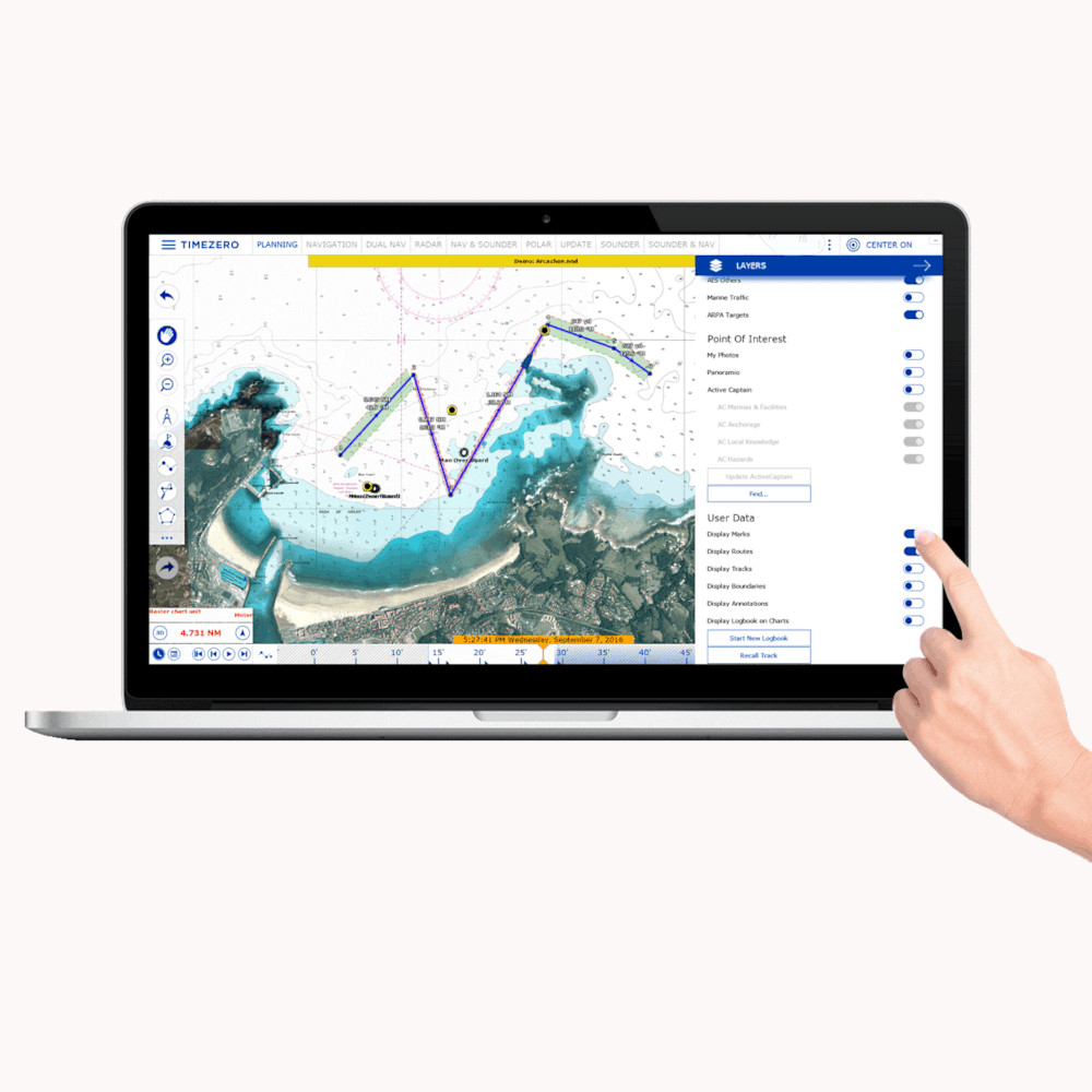
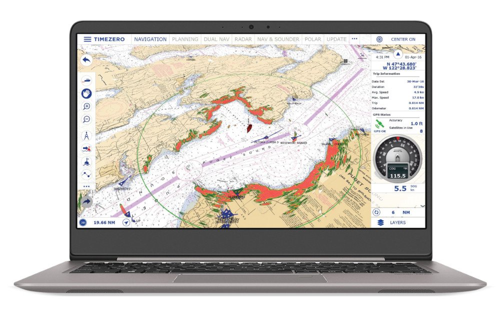
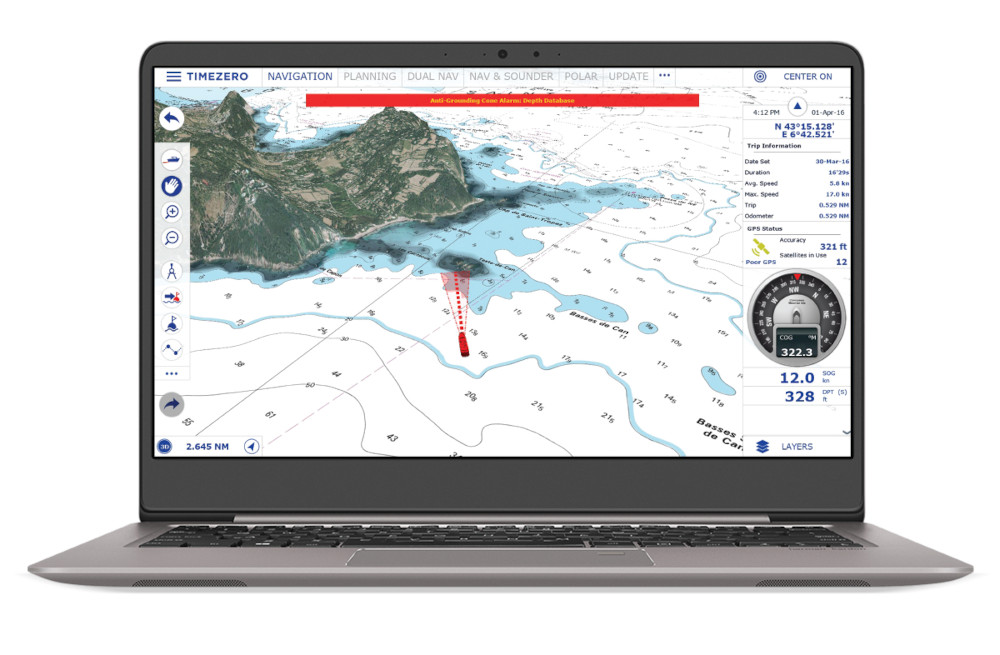
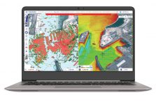
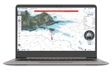
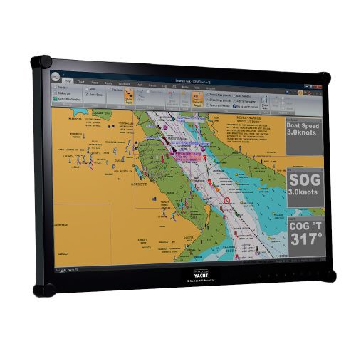
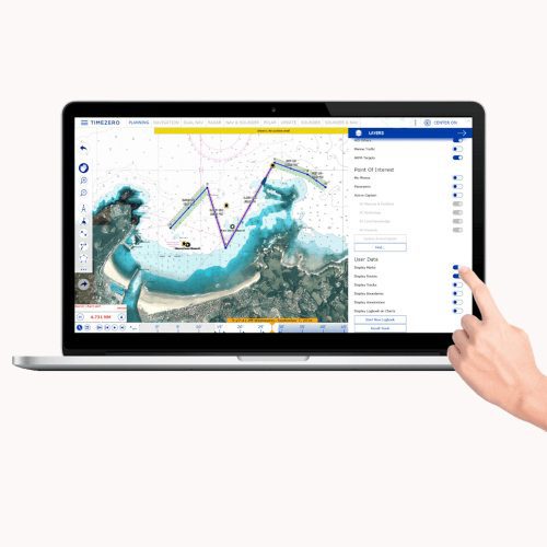
TimeZero Navigator is a sophisticated PC charting software package with advanced navigation and AIS capabilities and a wide choice of charting formats. Have the world at your fingertips thanks to the MapMedia charts catalog compatible with TZ Navigator. The introduction of TZ MAPS, a revolutionary nautical chart format, gives you access to all types of data available for your area: Raster, Vector, detailed land information, high-resolution satellite photos, and high-resolution Bathymetry. In addition, TIMEZERO technology integrate an unparalleled chart engine where marine charts, 3D data, and satellite photos are intelligently combined through PhotoFusion. Charts can be viewed at www.maxsea.com
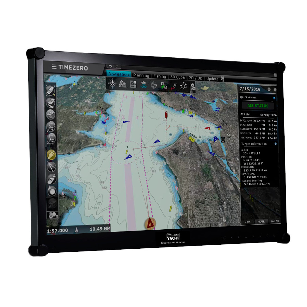
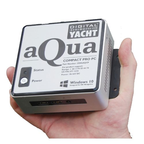
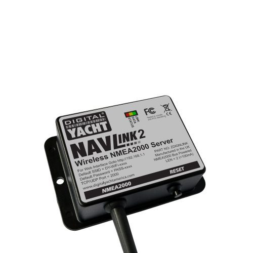
Timezero Navigator is ideal for use on the Aqua Compact Pro and Pro Plus systems. It’s fully compatible with Windows 10 & 11 and also with our iKonvert USB-NMEA 2000 gateway, USB-NMEA 0183 adaptor and NavLink wireless gateways. It also supports an autopilot output via our USB-NMEA 0183 adaptor. Create marks, waypoints, routes, boundaries, lines, annotations & even add a photo as user objects. Waypoints and routes can also be sync’d across the cloud and used in the TZ iBoat iOS app for an integrated tablet and PC solution. Full AIS display capability with CPA/TCPA alarms and target list and integration with internet AIS like Marine Traffic if an internet connection is available. Download weather for an animated display layered onto chart with wind, temp, pressure and wave information.
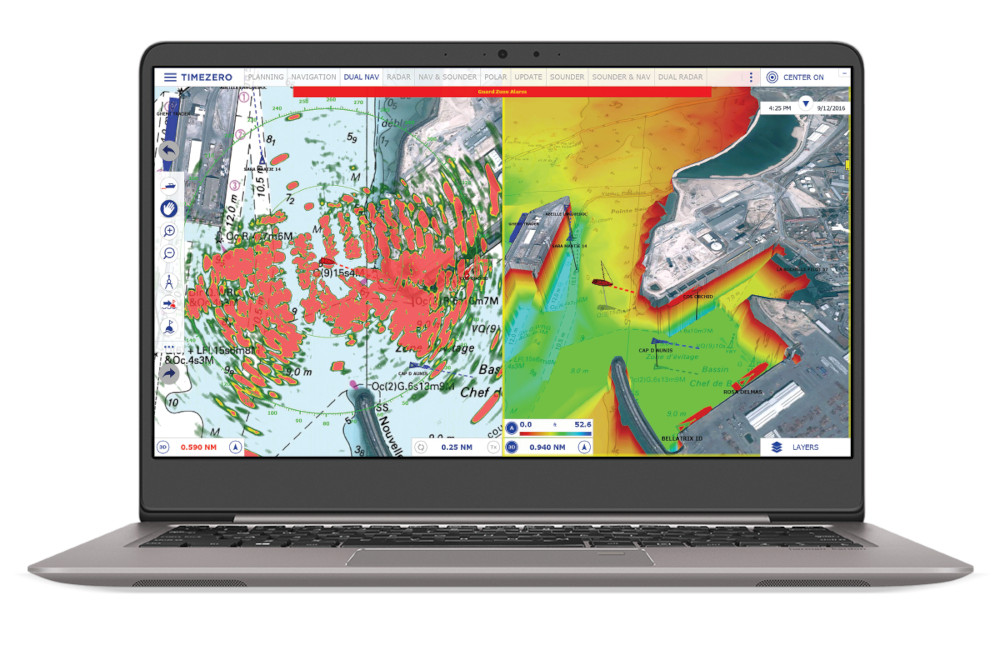
Options include Radar Module (compatible with new Furuno DRS4DNXT radars), Sounder Module and Weather Routing Module. The Weather Routing Module is ideal for long distance sailors and provides routing according to wind, waves and currents with isochrones overlay. Routing calculation automatically avoiding the coastline and shallow water (with possibility to set the depth limit), dual route calculation sail/motor (depending on the wind and theorical speed limit) and expected wind conditions display along the track.
Delivered as a digital download or pre-installed on our Aqua PCs, it comes with a licence for up to 2 PCs. Charts are not supplied with the software.
SPECIFICATIONS
- Supported PC Operating Systems: Windows 10 and Windows 11
- Connection to Instruments: SeaTalk 1 (via STN adaptor), NMEA0183 (via USB-NMEA adaptor) or NMEA2000 (via NavLink)
- Autopilot Output Connection
- Exclusive TIMEZERO Chart Engine (2D and 3D View with Seamless Chart Redraw without limited range presets)
- Friendly Touch Screen compatible User Interface
- Day, Dusk and Night Mode
- Worldwide Planning Charts (base map)
- Worldwide 3D Database (base map)
- mm3d Raster or Vector chart compatibility (from various manufacturers such as C-MAP, Navionics or MapMedia)
- Exclusive TIMEZERO PhotoFusion (intelligent mix of satellite photos and nautical charts)
- Depth Shading (color according to depth overlaid on the chart)
- Worldwide Tide Database
- Tidal Currents for North America
- Optional Western European High Resolution Tidal Current (refer to chart catalog for availability)
- Optional Accurate High Resolution Satellite Photos for Bahamas and Europe (refer to chart catalog for availability)
- Multi-level Undo & Redo
- Unlimited Track Recording (with track recall feature)
- Advanced Route Planning Wizard (Route Departure Time Optimization according to Tidal Current)
- Anti-Grounding Cone
- Planning Route Safety Check
- Lost Sensor Alarm
- Print Route Feature
- Odometer NavData (Duration, Distance, Max Speed, Average Speed)
- Marks, Waypoints, Routes Boundaries, Lines, Annotations & Photos (User Objects)
- Synchronization of User Objects (Local and Cloud synchronization) among compatible TIMEZERO Platforms)
- Unlimited User Objects (3)
- Worldwide Place Name Search
- POIs: Import your own Photos (“My Pictures”) with Automatic Geolocation
- POIs: ActiveCaptain (Interactive Cruising Guidebook)
- Weather Data Service (Rain, Cloud, Air Temperature, Wind, Waves, Oceanic Currents, Pressure)
- Weather Forecast, Tides and Currents Animation
- Alarms (Anchor Alarm, CPA/TCPA Alarm, Depth Alarm, and more…)
- AIS and MARPA Target Display (with targets list)
- AIS and MARPA Graphic CPA
- Target Track Recording
- AIS Marine Traffic compatibility (Global AIS feed through an Internet connection)
- Digital Selective Calling (DSC) and Man Over Board (MOB)
 United Kingdom
 United States
 France
 Europe
 Germany
 Australia
 Spain
Spain Italy
Italy
